|
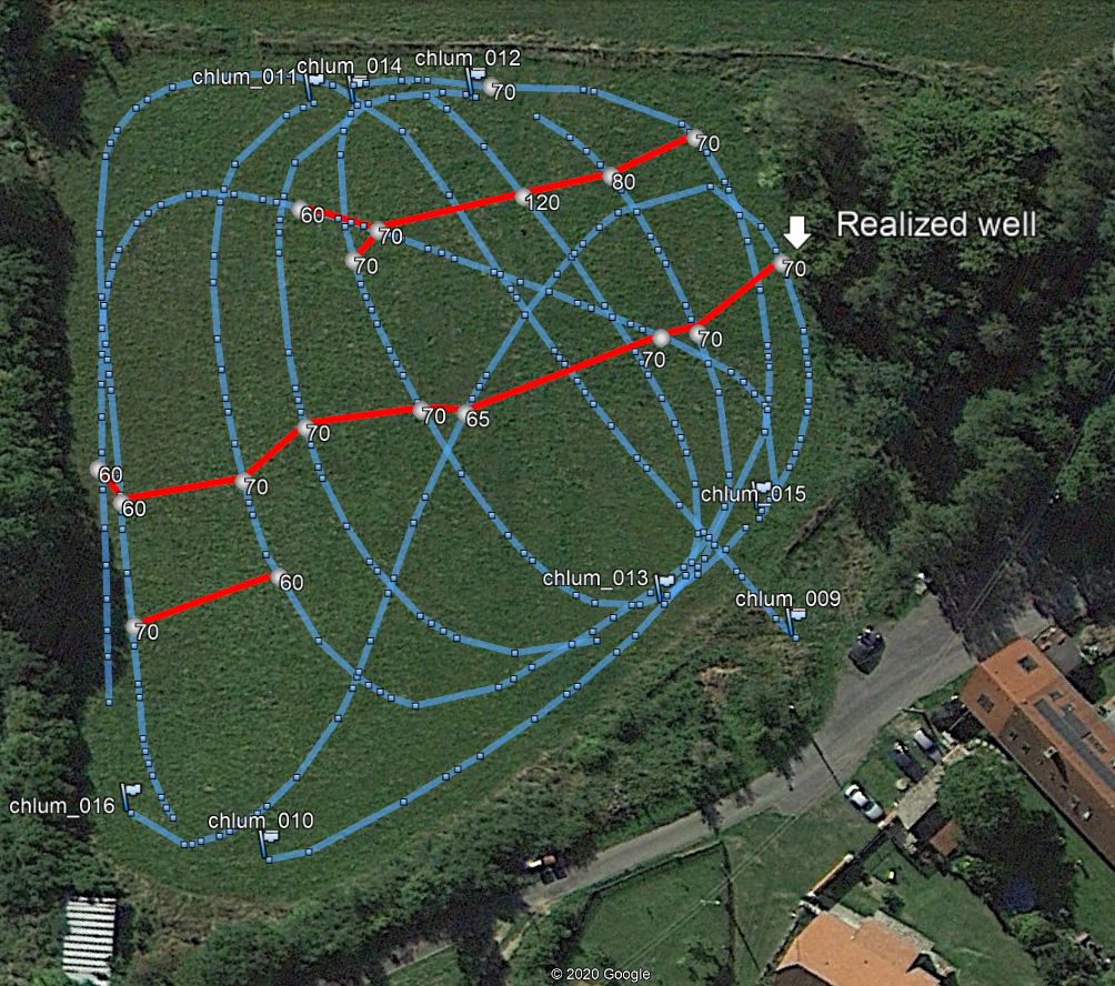
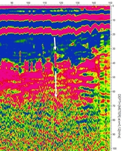
In practice, it looks like the water source is being sought on a certain plot of land or land of the owner or municipality. In this case, the space is measured according to size with one or more profiles (blue point trajectory according to GPS). If it is possible to find waterlogged cracks or even their crossing, they are marked in the plan and the most suitable place for the well is determined according to the radargrams. Here, the borehole in the direction of the crack reached a water source at a depth of 40 m with a yield of 1,400 l / hour. In the area of the meadow, a well up to 50 m deep was previously drilled outside the marked cracks, its yield was around 100 liters per day. They have been looking for water here in various ways for 30 years. Chlum area near Orlík (CZ).

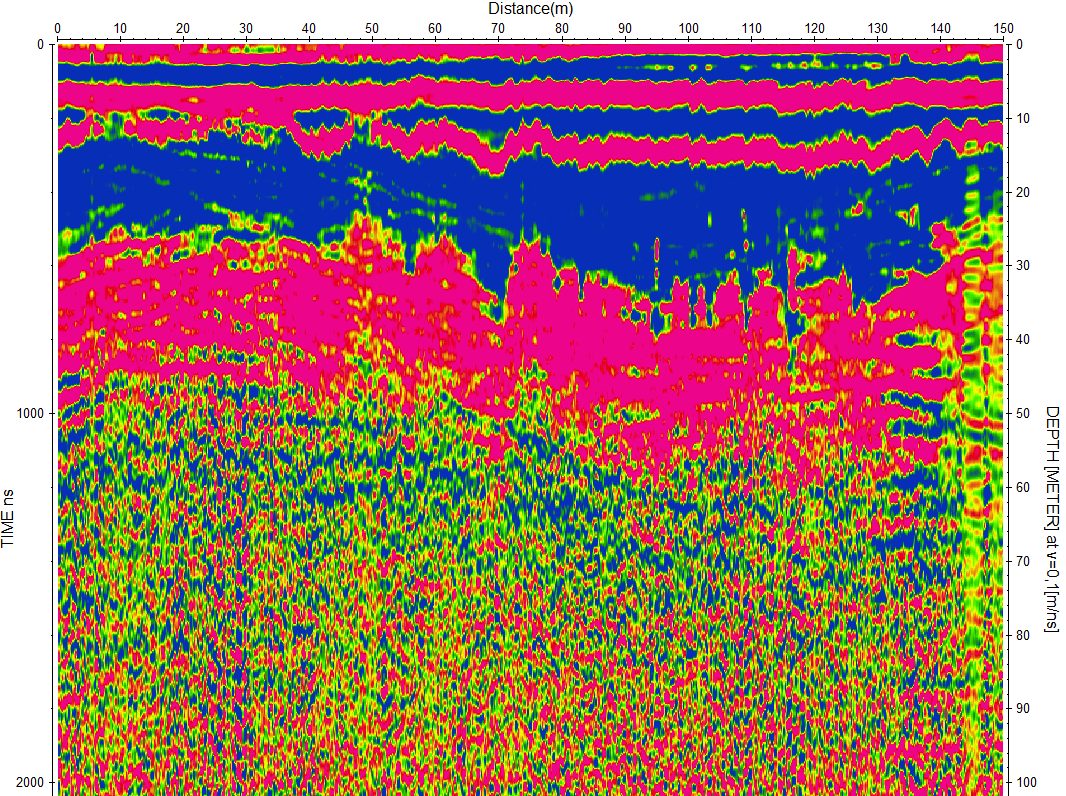
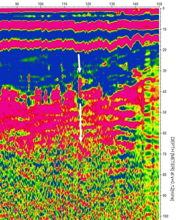
Radargram filtered so that the area of low frequencies is visible at the same time as the crack structure. White arrows indicate a crack. Horizontal aquifers can be seen at depths of 40-60 m, the well probably caught one of them. There are gneisses, we are about 100 m above the Vltava river.
|