|
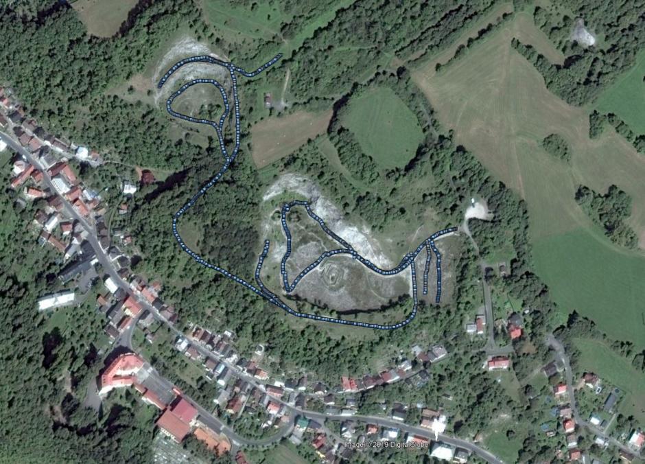
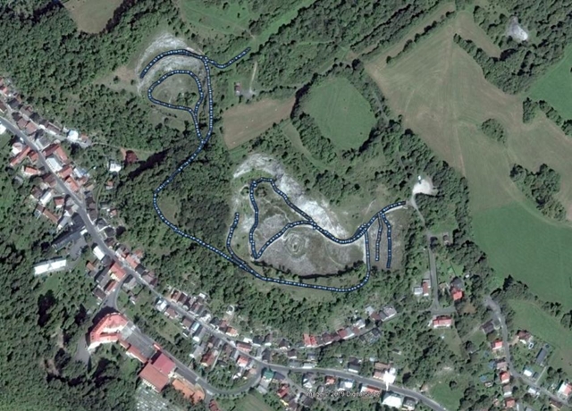
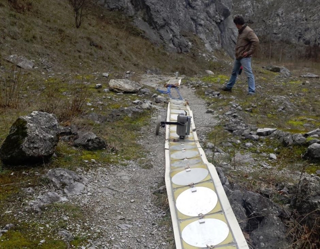
Nowadays the limestone quarry near Štramberk is closed, the mining there has ended and currently serves only as a nice excursion place, also sometimes future geophysicists from the Báňská Univerzita come here for geophysical measurements. It was a bit of surprise for me to see such a huge limestone formation here. Even though the thickness of the limestone is less than 100 m, there are still karst cavities. I managed to find one bigger cavity with Mr. Kalenda almost in the middle of the abandoned quarry. Of course there may be more, however we measured only a smaller part of the area.
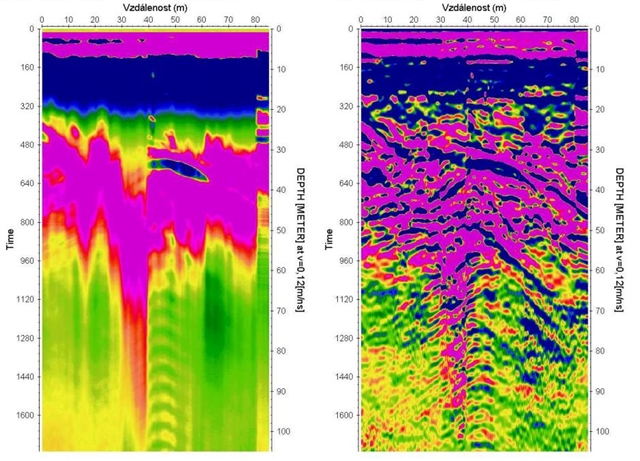
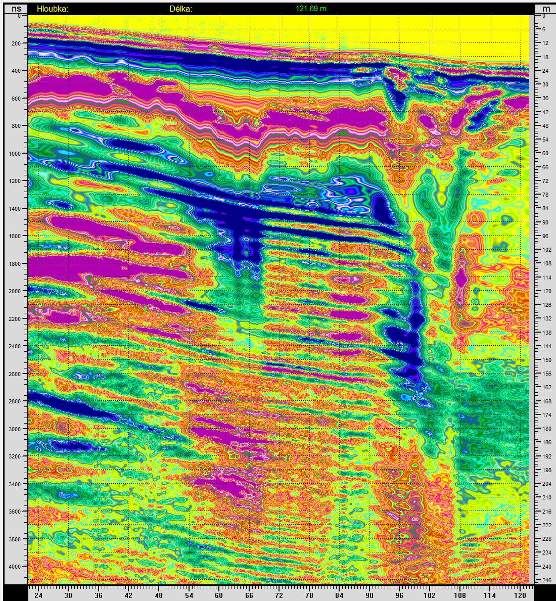
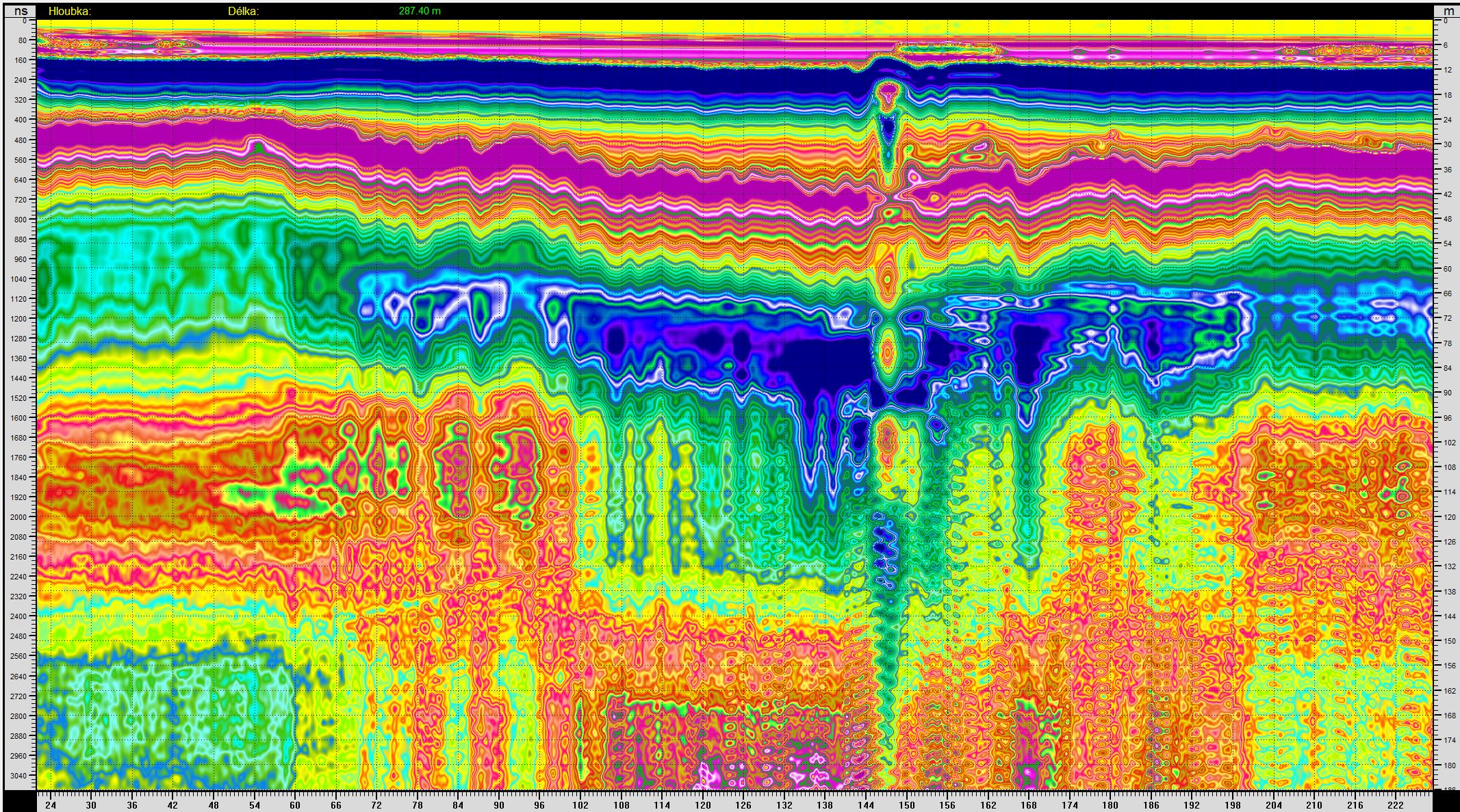
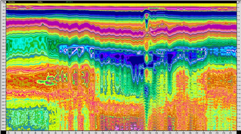
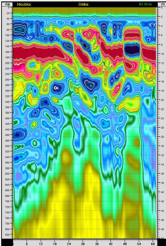
You see that the good information (the blue arc-cavity) in the right image merged with the other reflections and does not appear to be a priority. All we need to do is to combine the pictures and we have information from both. Vertical breaks with block shifts can be seen better, too.

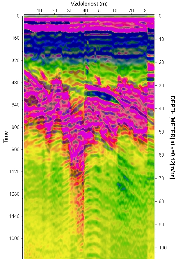
If the blue area is a cavity with air, then the scale does not apply to the depth on the right side, because the wave velocity is about 2.5 times higher in the air than in the limestone. Then the cavity would not be 3 m but 7.5 m in height. The cavity is also supported by the resonance reflections that arise in the cavities, that is the column of arches at the bottom of the figure below the cavity.
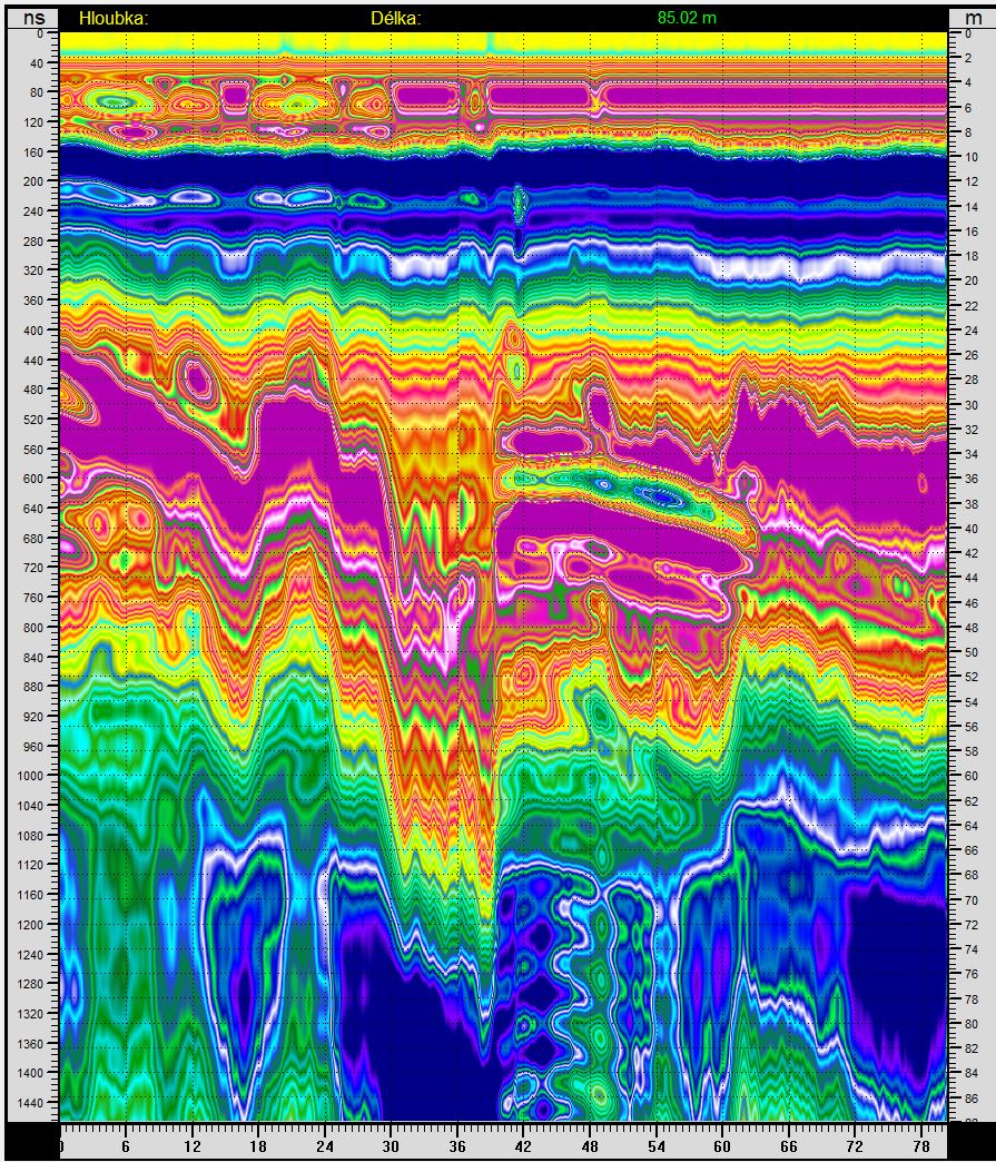
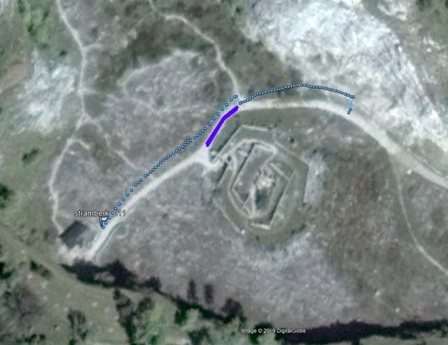
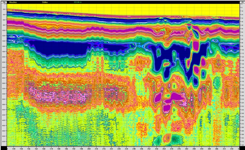
At the beginning of the profile there was a small shed with barred entry into the underground. There are no large cavities on the radarogram, but the path to the cavity could go there. It is the blue reflection that starts at the far left at a depth of 20 m. A few perpendicular profiles to this measured one would surely tell us how to reach the cavity as best as possible.
Appendix 12/2020
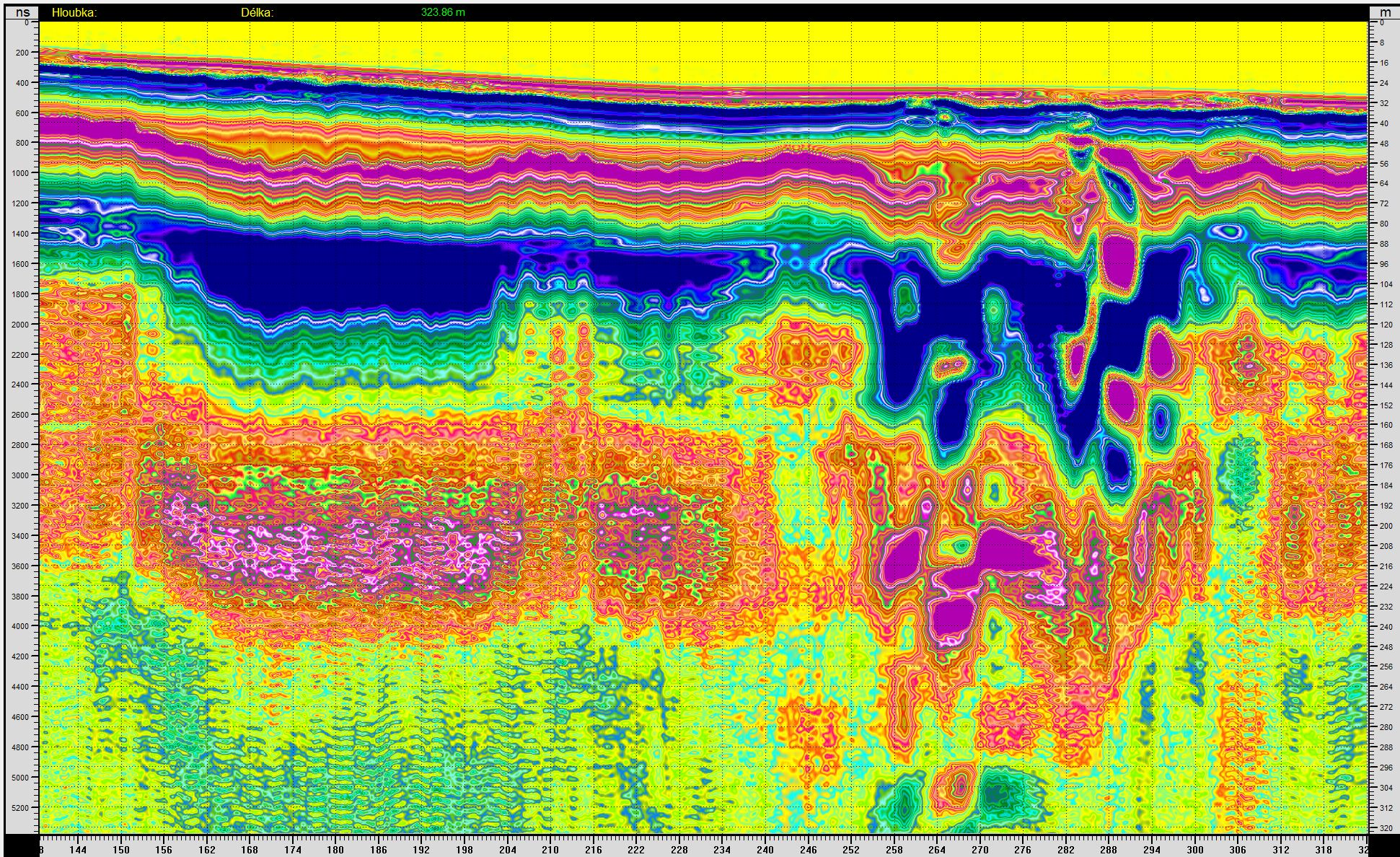
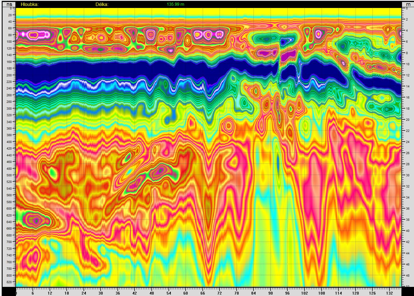
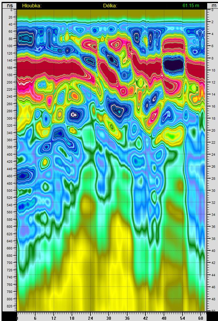
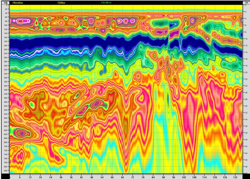
Several other interesting things processed by the Spirio program. Color shades are used as isolines.


|