|
When measuring with the ROTEG georadar, we often come across cracks in the subsoil, various fissures and, exceptionally, geological breaks or other interesting anomalies. I have selected a few of them for you to view here. I also tried to describe the geological situation a little, what it could probably be, according to the available information from the geological map or the surrounding environment. Georadar does not recognize the type of rock, we can only infer the change in permittivity or conductivity, these values are greatly influenced by the water content in the rock. Vertical cracks are only noticeable when they are more than about 1 m wide. The wave does not reflect from the vertical interface, we can see the filling if it is made of a different material.
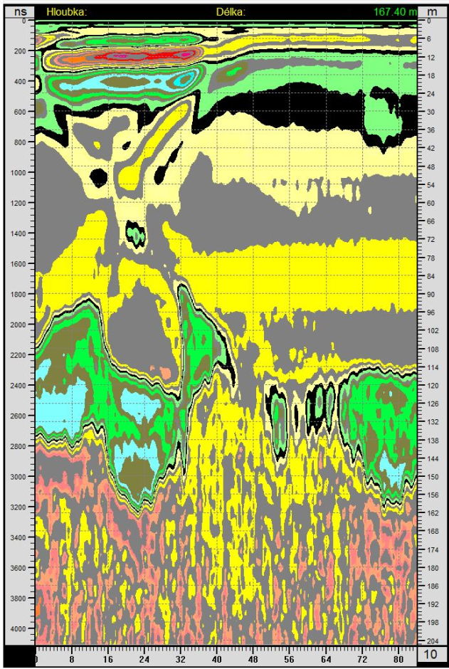
A crack in the limestone at a distance of about 26 m. The red-orange areas at the top to a depth of about 8 m may be sands or gravels, the light blue area is probably claystone and marlstone with a higher water content. The brown area below is probably limestone rock with a lower water content. It will probably be stronger than the rocks above it, which is why the clay is more clearly visible in it. The two small, yellow, vertical areas will also be cracks, going up. The measurement location is near Litoměřice (CZ), east of the Richard 1 mine. Nearby, sand and gravel were mined for concrete for reinforcements in the quarry.
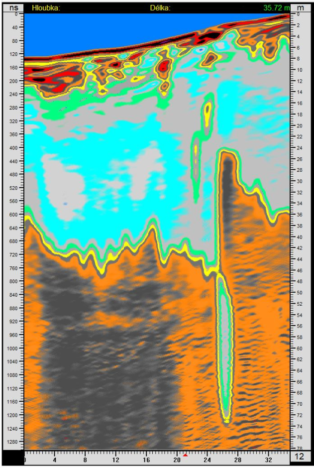
Down here, I measured the drop on the surface to a depth of 2m. It is marked with a black circle at a distance of 39 m. It is not a sinkhole into some tunnel, there is a fissure under the sinkhole that we can see up to a depth of about 50 m. In the upper part in light blue color are marls and claystones, below them in yellow to red colors limestone.
On the southern edge of Radobýl hill near Litoměřice (CZ), near the new bridge, there is this big crack.
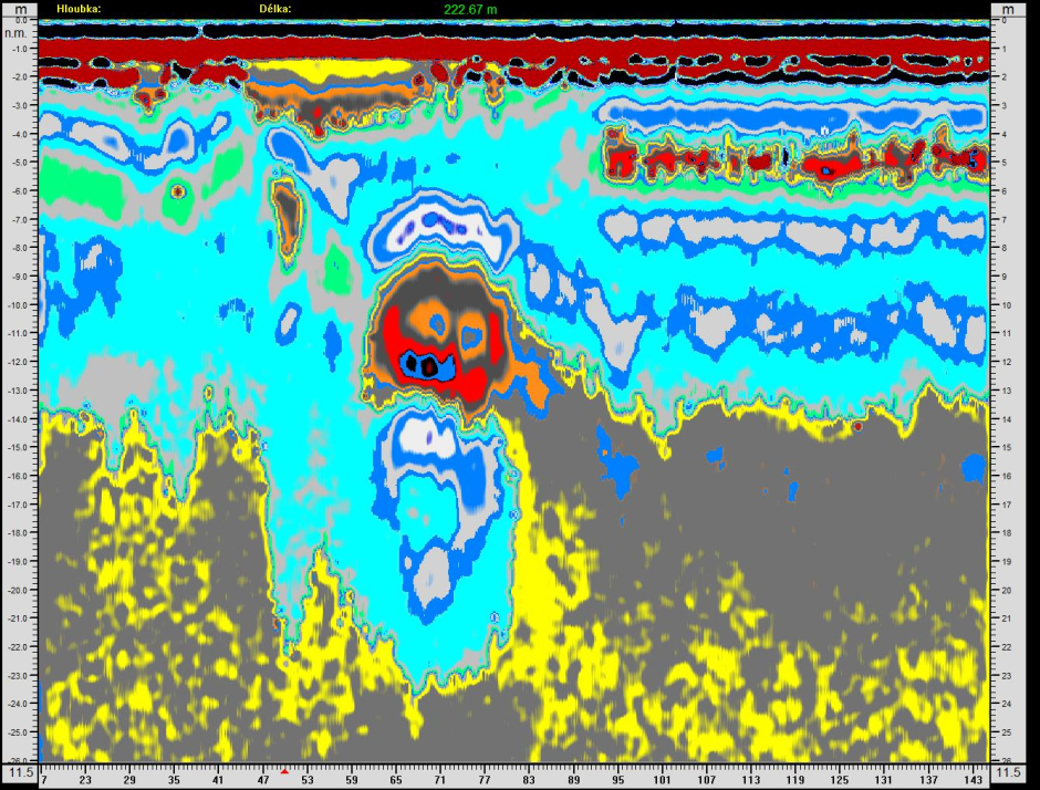
Apparently cavities with water are on the radargram near the village Lhotky in the Kouřim region (CZ), there is a geological fault nearby.

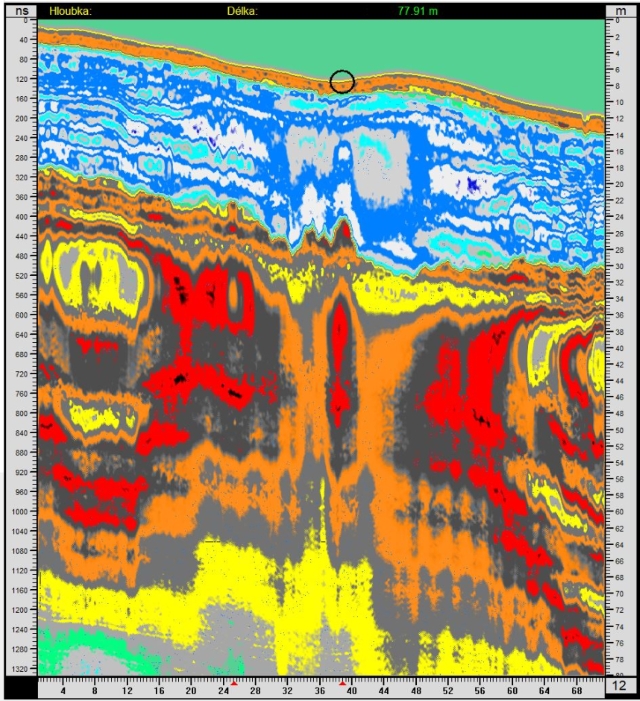
The northern edge of Bídnice hill near Litoměřice (CZ). We have no idea what that spherical formation is.
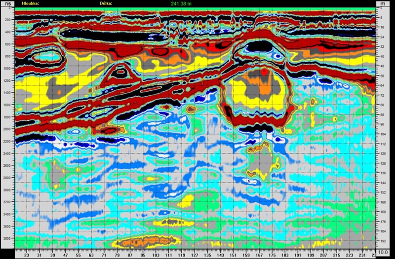
Even at shallow depths you can find interesting structures, Litoměřice (CZ). The spherical formation has a low permittivity, there may be voids or some chemical changes may have taken place due to the penetration of water.
Crack in sandy sediments and its fillings.
Cracks on the shore of Kamencové jezero (Alum Lake) in Chomutov (CZ). At a depth of 18-60 m there are clays, below them are sandstones.

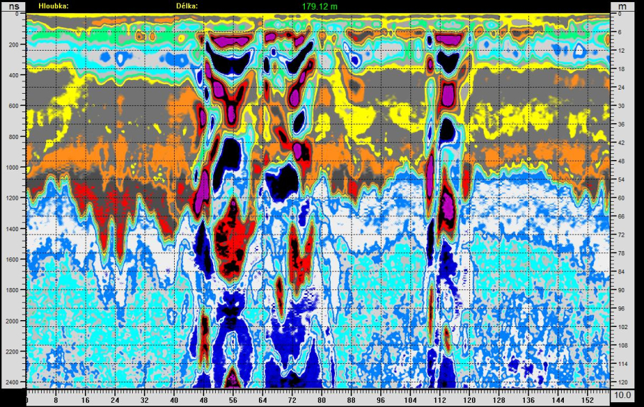
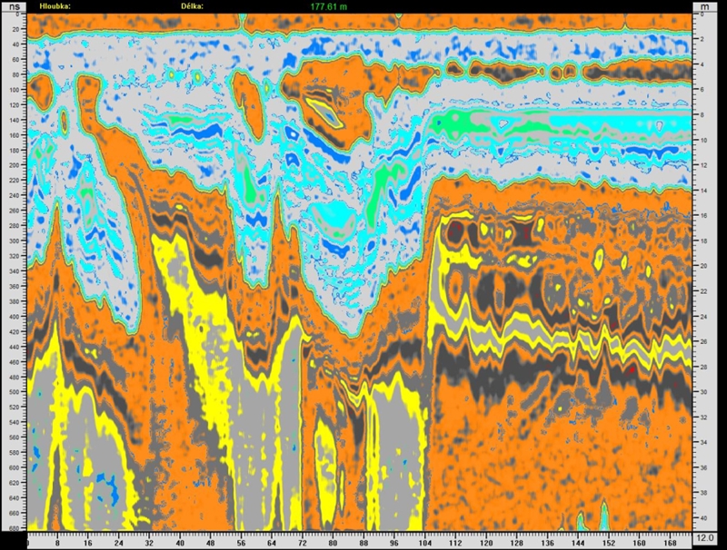
Inclined filling in a shale and claystone crack at a depth of 50 – 130 m. Knobloška (CZ).
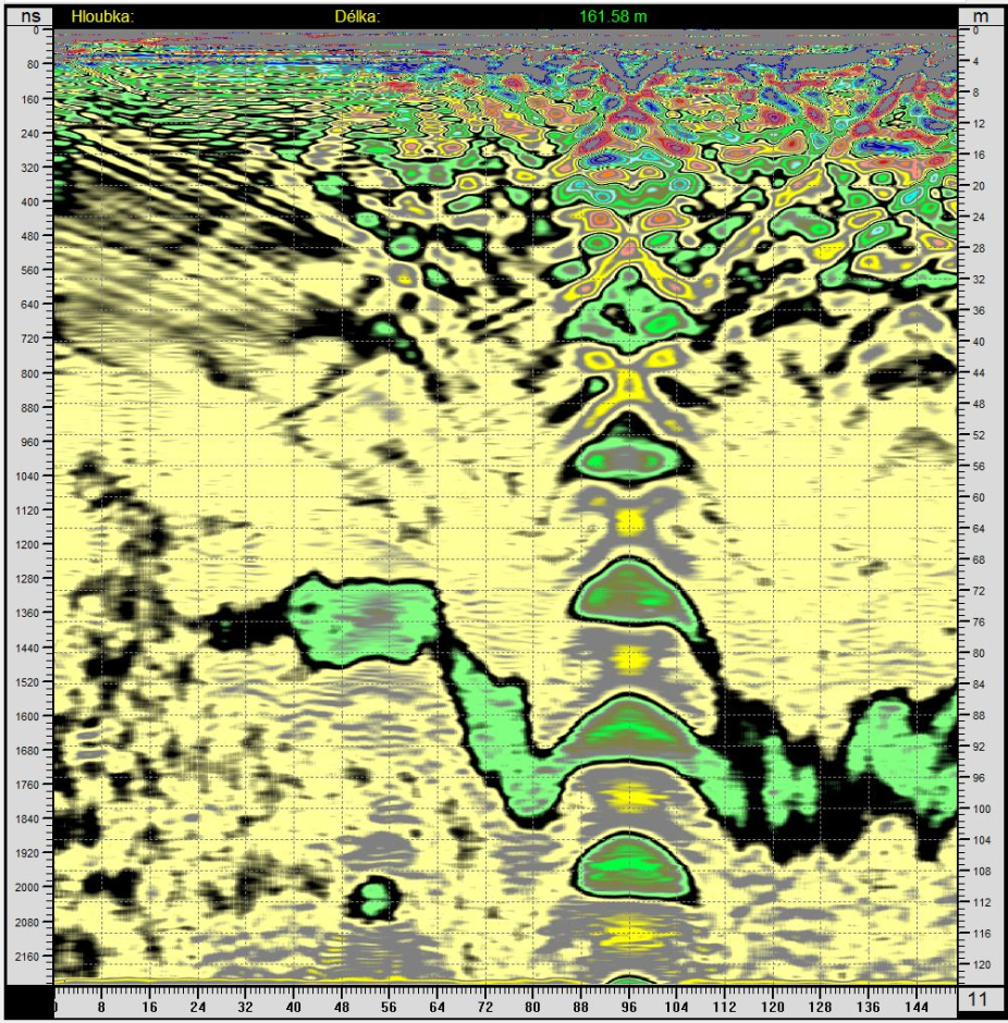
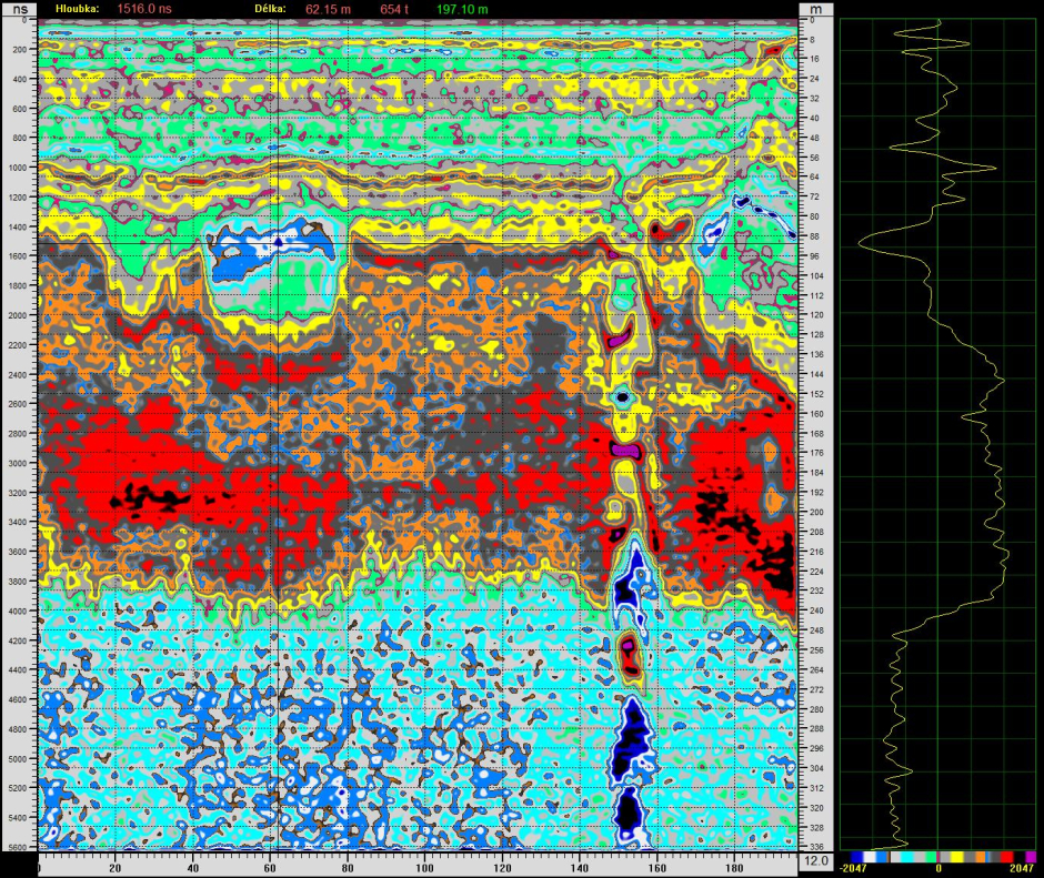
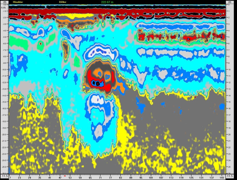
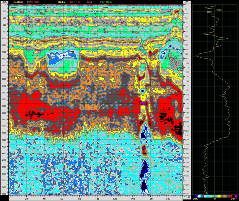
A crack with a series of cavities at a distance of 155 m. There is a blue area with water on the left at a depth of about 90 m.
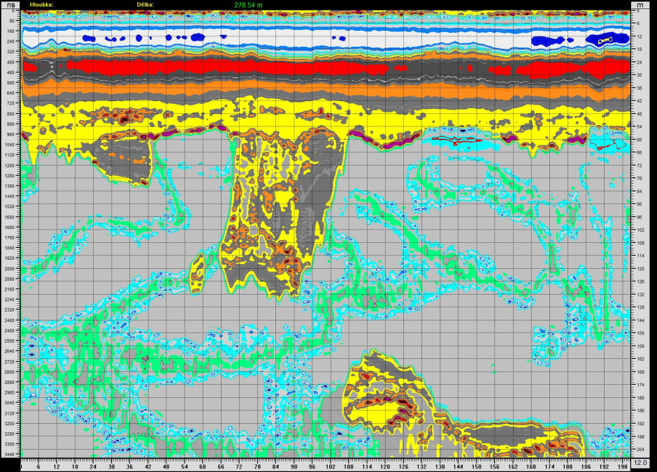
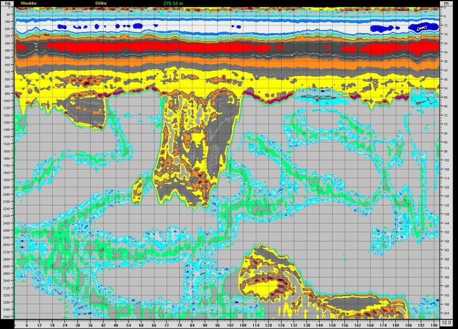
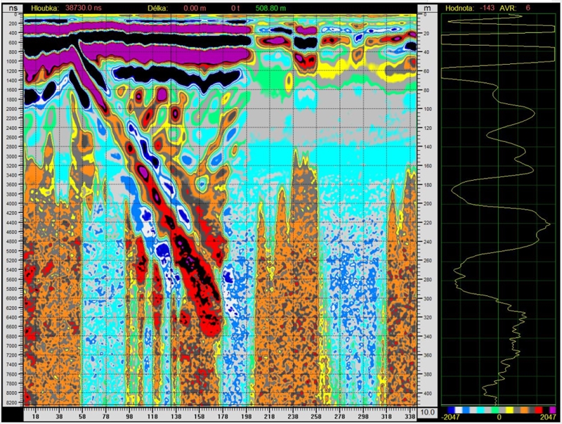
Oblique reflection to a depth of 340 m. Blansko, vicinity of Malá dohoda quarry, 12 MHz antenna, filtered to 500 kHz, gradient filter.
|