|
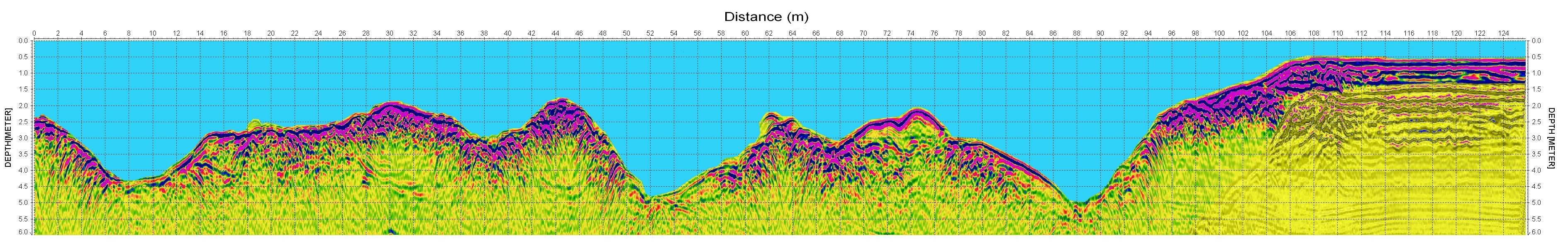
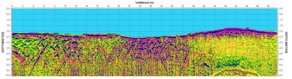
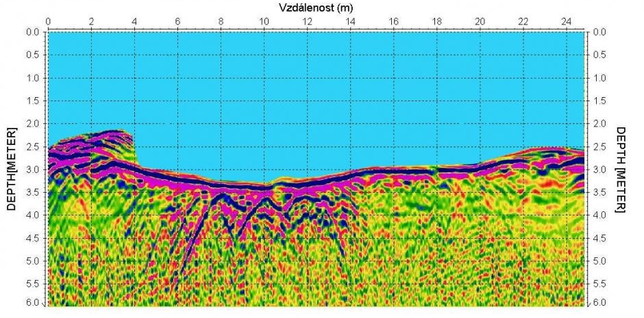
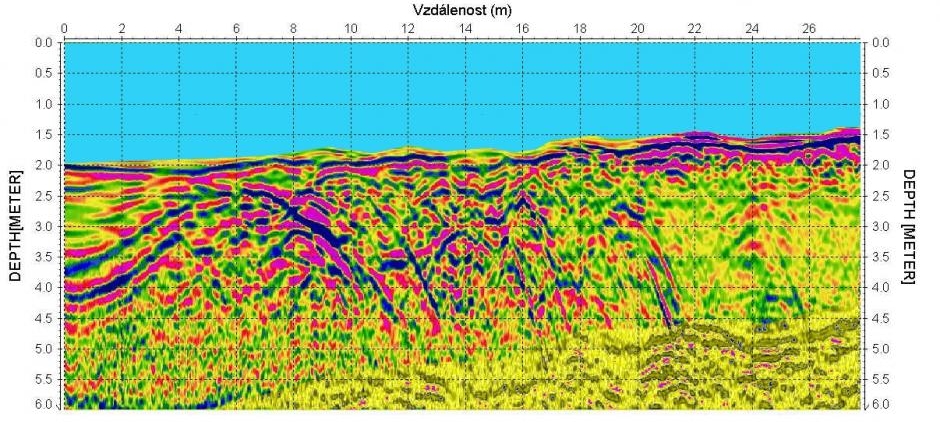
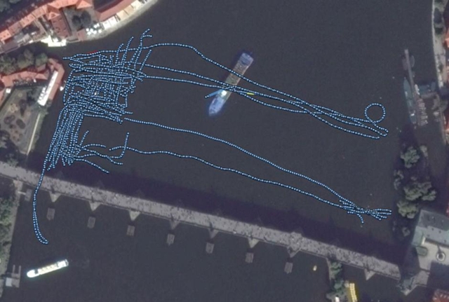
January 2019 was not the best time for georadar measurements on the Vltava River. However, the event was associated with archaeologists – divers, who in the winter months have the best visibility underwater. They are looking for the foundations of the pillars of the 12th century Judith Bridge, or at least what remains of them. “We will just try to use the georadar here, to find out whether there’s even anything to see.“, we said to ourselves. The divers delimited 50 x 30 m area by buoys for the survey. The radargrams on the screen were very legible, with a cross-section of the bottom, layers of mud, rocky terraces and large boulders. Mr. Starec (the archeologist) obviously liked it. „So let’s take a look at the opposite shore, let’s search a little bit, and here around those pillars it is interesting, take it there again…“ Finally, we did the survey on the marked area, too. The skipper was excellent and therefore we managed to measure the profiles even perpendicular to the river Vltava at certain intervals. We were on the water for 3.5 hours. 4.575 m profiles were measured.
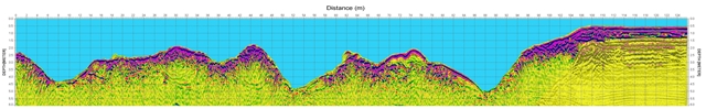
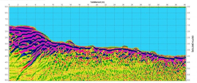
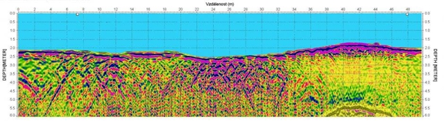
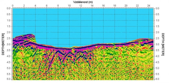
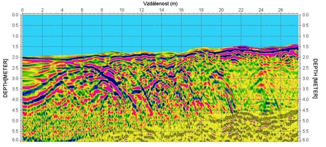
We measured a lot of profiles with georadar, almost 1 GB of data. 300 MHz antennas were used. Signal penetration below the bottom was 1-3 m – the strength of the signal depends also on the depth of the bottom. For a deeper penetration it would be possible to use antennas with a length of 1 m with a frequency of 150 MHz. Maybe we will try it next time on another survey. There is hard work ahead of archaeologists. They are supposed to mark areas such as large stones on the radargrams, enter the data into the area according to GPS data, and perhaps they are going to find a place with a pillar of Judith Bridge.
|